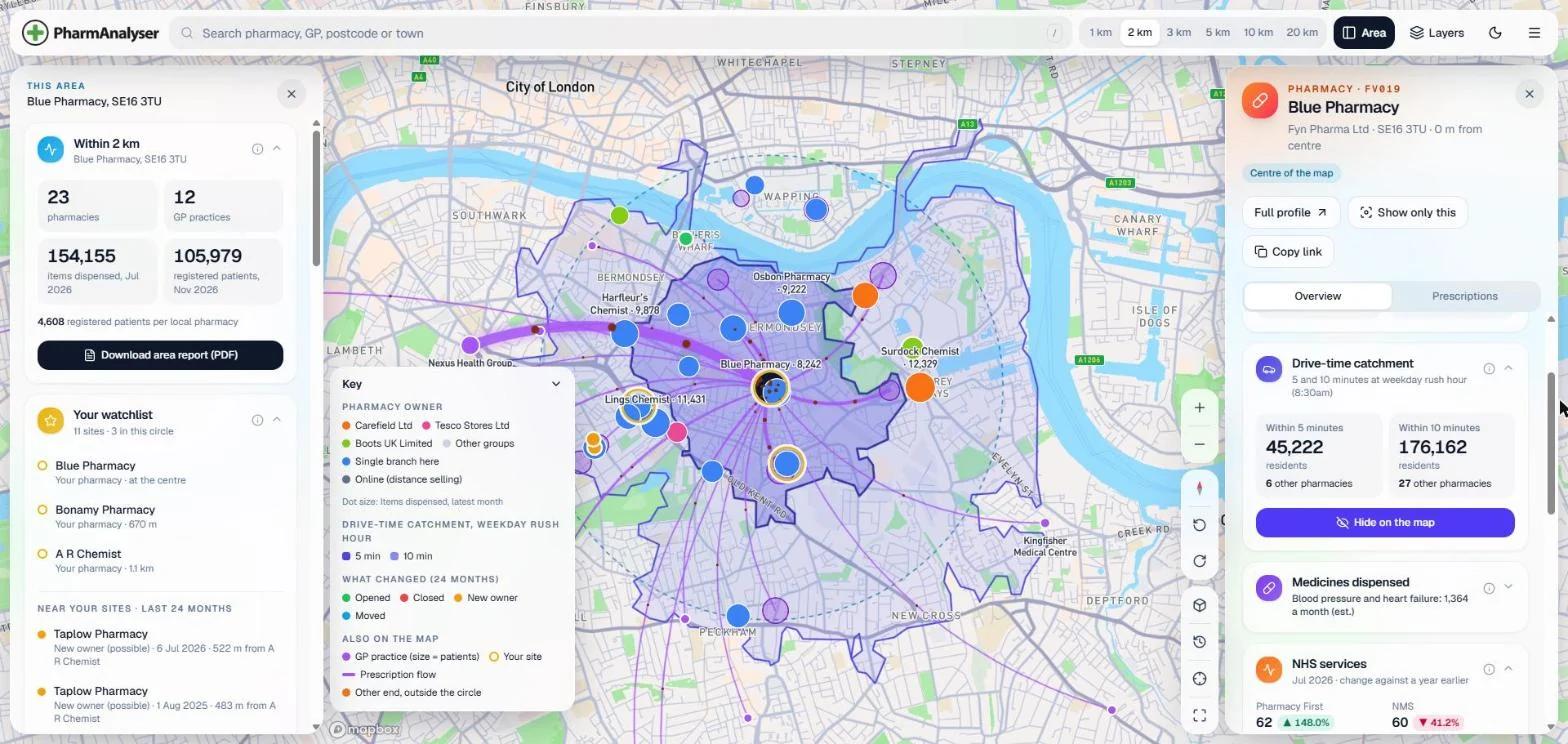
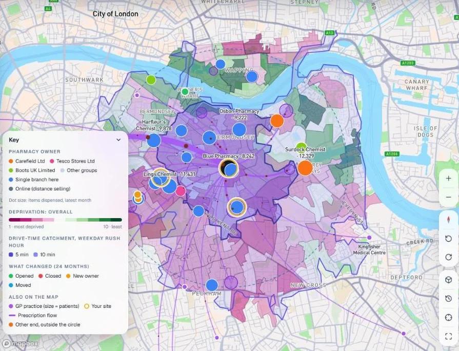
The map
Search a pharmacy, practice, postcode or town and see every pharmacy and practice around it.
Open it from Interactive map in the menu (☰). Search a pharmacy, practice, postcode or town and choose a radius from 1 to 20 km. The map shows every pharmacy and practice in the circle, with panels that sum the area up.
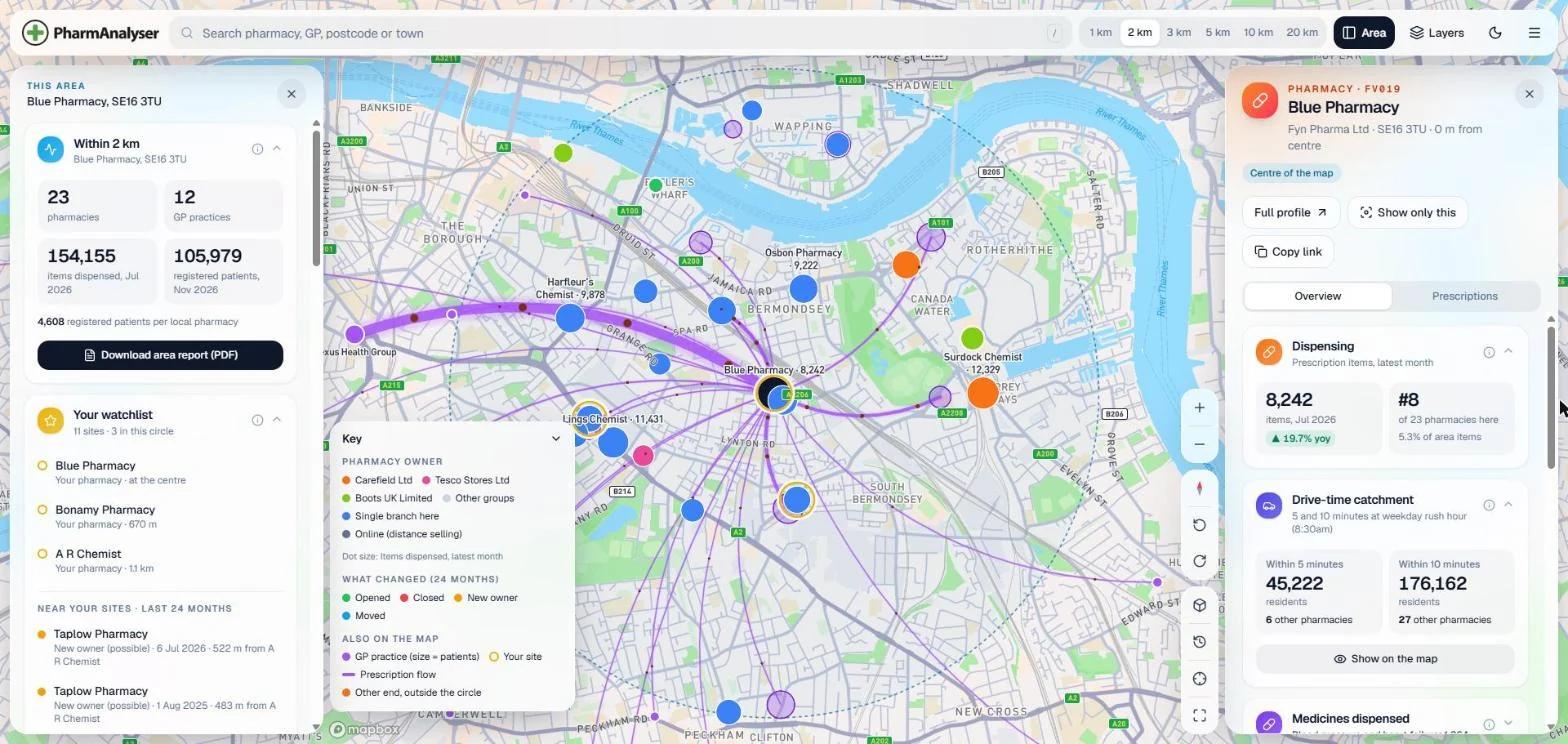
| Part | What it does |
|---|---|
| Top bar | Search, radius, Area to open the area panel, and Layers |
| Area panel | Counts, people, prescribing, your watchlist sites in the circle, openings, closures and new owners, NHS services and more. Download area report (PDF) |
| Pharmacy panel | Click any pharmacy: items and rank in the circle, drive-time catchment, medicines dispensed, NHS services, inspection and owner history. Copy link shares the view |
| Key | Bottom left; explains whatever colours are on screen |
| Neighbourhood evidence | Scotland: draw a neighbourhood and see the evidence a Pharmacy Practices Committee weighs on a new application |
Layers
Click Layers at the top right. Everything is a switch or a choice, and the map changes as you click.
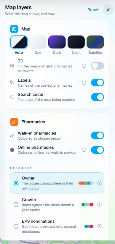
| Layer | Options |
|---|---|
| Map | Day, dusk, night or satellite. 3D raises pharmacies as towers. Labels name the busiest pharmacies |
| Pharmacies | Walk-in and online, shown separately |
| Colour by | Owner, growth, EPS nominations, activity, inspection, opening hours or NHS service fees |
| Size by | Items, or an NHS service: Pharmacy First, NMS, flu, COVID, blood pressure checks, contraception, smoking cessation, discharge medicines and more |
| Show only | One owner, a minimum number of items, 100-hour pharmacies, or those that didn't meet every inspection standard |
| GP practices | Sized by patients. Colour by patient growth, patient experience, getting through by phone, appointments per 1,000 patients, or prescribing of a chosen medicine |
| Your watchlist | Rings around your sites |
| Care homes, dental | Click a care home for its detail |
| Shade small areas | Deprivation, people aged 65 and over, or medicines prescribed |
| Analysis | Heatmaps; walking or driving time from the centre; opportunity grid; nearest-pharmacy areas; drive-time catchment; prescription flows; what changed |
These are the options for England. Scotland, Wales and Northern Ireland offer the ones their data supports.
Two views worth trying